
Martin Taylor takes us on a trip along the River Perry...
TODAY, the River Perry has little influence compared to years ago.
I would refer to it as being a ‘forgotten’ river. Many motorists today would probably give it little thought when crossing over the Platt Bridge. I am of the opinion maybe Ruyton-XI-Towns would not have existed if the river had not been there. The river would provide what was obviously the main source of water for any future settlement.
The source of the River Perry is at the little village of Hengoed which is situated approximately five miles to the north of Oswestry. The flowing river meanders through the land of Halston Hall. When it reaches here it turns into an extensive and complex lake system. After that it runs westwards beneath the Shropshire Union Canal, then reaching Baggymoor. This marshy ground was originally known as Boggymoor in past times. This area including the Ellesmere lakes are said to be noted ‘by-products’ of the Ice Age.
In 1783, the year when Great Britain ceased hostilities concerning the American Revolutionary War, an attempt was made to drain the Baggymoor, but this was still being tried during the 1980s. In the 1700s the work of draining peaty wetlands would be a major task. It would take many workers and a lot of spades! Also in 1783, the first hydrogen-filled balloon (Le Globe) took to the skies in Paris, France. In Ireland, Waterford glassmaking starts production.
The name Perry has been spelt in various ways. These include Peover, Peverey, Pevereye and Peueree. The word Perry originates from the Welsh word ‘pefr’, meaning radiant, resplendent, bright and beautiful. This certainly can describe this river but at times dredging and pollution has ‘contaminated’ its description.
According to the Domesday analysis, there were no less than five fisheries on the river in the Ruyton area. This was seemingly disputed in 1357 (incidentally, 1357 was the year of the first public exhibition of the Shroud of Turin) when it appeared there were eight. One remarkable letter was found in the records from 1861 dated June 20. The letter was sent to the Reverend Wilkinson of Ruyton from Mr Rowland Hunt of Boreatton concerning fishing rights on the River Perry. Mr Hunt said he has every right to fish on his own side of the river. He then said he had fished on the river employing the use of coracles. However, he was not too enthusiastic about this because coracles were not all that practical and feeling most restricted on such a narrow river. Besides that, he said there was nothing really worth catching!
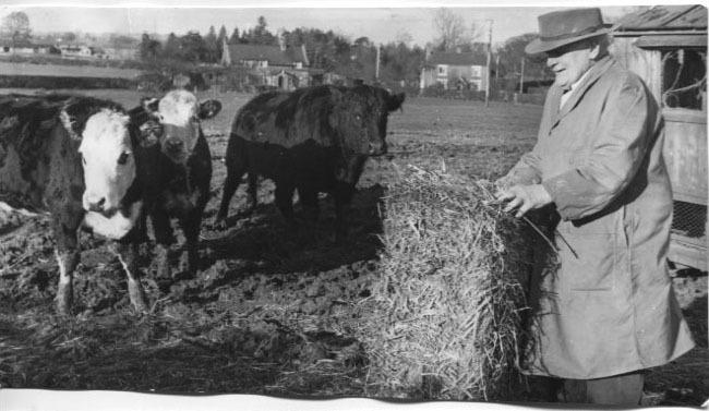
As regards the River Perry, I lived on a farm as a child (many years ago!) which in part was bordered by this small river. I shall never forget those summer days standing by that river with its soothing, tranquil flow. (This is not a ‘wild’ flowing waterway). I was most fortunate to be living at this farm close to the River Perry.
As it flows from Baggymoor area, the river reaches the level steep-sided vale between Wykey Bridge and Platt Bridge. It appears this valley was created out of the encased sandstone when surges of water were caused by melting ice at the demise of the Ice Age. As the river carries on, the landscape begins to change somewhat. The River Perry is then to be seen flowing through farmland and the parkland known as Yeaton Pevery. Shortly afterwards in runs into the River Severn at Bromley Forge which is sandwiched between Forton Heath and Montford Bridge. Incidentally, the River Perry has a length of about 22 miles.
In years gone by there have been many mills in this country. At Ruyton-XI Towns, its own mill was sited at the end of Fern Hollow or Parry’s Lane although this appears to be a certain distance from the river. However, the course of the river was diverted in relation to the 1783 and 1861 Drainage Acts. (A little confusing!). It is assumed the mill was perhaps erected by John le Strange I. He instigated Ruyton Mill and other mills in the area to be under the responsibility of the monks of Haughmond Abbey. The monks in return would be allowed certain privileges, such as free rights to his estate. They would have permission to use wood, turf and soil etc from his land in order to maintain the mills. I would say this was quite a clever system.
A lease by John de Penyton was taken on the weir at Ruyton in 1354. This would relate to the mill pool and its fishery.
The estates under the name of Craven were sold in 1777 and Lot 5 was portrayed as Ruyton Mill and Mill Moors. It was held by Mr Benjamin Randles and his modest abode consisted of no more than a couple of rooms. The mill was attached to it, allied to a cow house and stable.
Due to the 1783 Baggymoor Drainage Act, some of the Ruyton Mill was removed and in 1861 there was a total removal. Remnants of the mill such as the mill stones were utilised for other uses or purposes. The mill stones were laid out on the floor of a cottage close by. The last miller was said to be a Quaker by the name of Birkfell. Where the mill once stood was later a piece of land called Mill Meadow, apparently part of Kynaston Farm.
Regarding Platt Mill, records suggest it was first referred in 1195 when John le Strange II purchased some land from the Abbott of Shrewsbury. It was in order to expand the Deer Park. This area of land is situated in the loop of the River Perry on the Baschurch side.
Yet another Platt Mill was later established and this time by John le Strange III. This mill was situated on the Ruyton side of the river. The possibility of its exact site was in the Doctor’s Meadow somewhere below the village church which is close to the plantation of poplars. Nevertheless, this particular mill in 1269 was relocated to Staniwere on the Baschurch side somewhere near where Platt Mill Farm was later to be. It seems no more mills were to be built on the Ruyton side of the river unless they were under the pledge of Haughmond Abbey. The ruling did appear to change somewhat after the Dissolution of the Monasteries when the two aforementioned mills were incorporated together. In 1608 this involved a lease conformity between George Onslow of Boreatton and Thomas Clyne of Walford. The description now was ‘Two mills under one roof’.
For some reason a small riot developed in the area in 1768. This resulted in the destruction of the mill dam owned at that time by Thomas Hunt. A number of offenders appeared at the Shropshire quarterly sessions and charged.
Not too far away from Ruyton, John le Strange III built another mill near Pradoe on the small Weirbrook. It has been questionable how a diminutive stream could have to power to rotate the wheel of a water mill. This was rectified by assembling a dam to replenish a reservoir. The water from the reservoir would be discharged to revolve the wheel. Obviously the wheel would cease to turn when the reservoir was empty, which had to be filled again. This operation seemed to work well at this mill because it was not a mill of a high capacity.
Heath Mill was bestowed to Haughmond Abbey by John le Strange IV in 1267. It was eventually dispensed with in the 18th century. In 1875 an account in the Parish Magazine comments that the old mill stones could be observed at the entrance to a cottage doorway.


Comments: Our rules
We want our comments to be a lively and valuable part of our community - a place where readers can debate and engage with the most important local issues. The ability to comment on our stories is a privilege, not a right, however, and that privilege may be withdrawn if it is abused or misused.
Please report any comments that break our rules.
Read the rules here